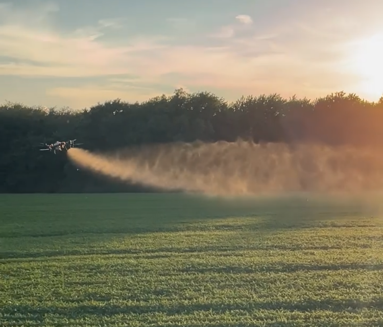
From agriculture and mapping to storm assessment and thermal imaging — Aerofinity Drones delivers dependable results with safety-first planning and fast turnaround.
FAA Part 137–certified aerial chemical application and precision field services. Aerofinity Drones provides compliant, insured drone spraying solutions designed to improve efficiency while reducing ground impact.

Accurate aerial mapping for landowners, surveying support, and project planning. Ideal for acreage measurement, documentation, and progress tracking.

Quickly document damage after severe weather with high-resolution aerial imagery. Great for insurance documentation, roof checks, and property records.

Thermal imaging for inspections and diagnostics. Useful for spotting heat anomalies and supporting maintenance decisions.

Tell us what you need and where — we’ll respond with availability and a quote.
Request a Quote